
Francine Strengthens Into A Hurricane
News Staff • September 10, 2024
Francine is officially a Hurricane with winds over 74mph
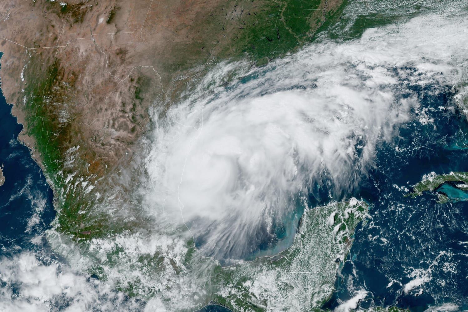
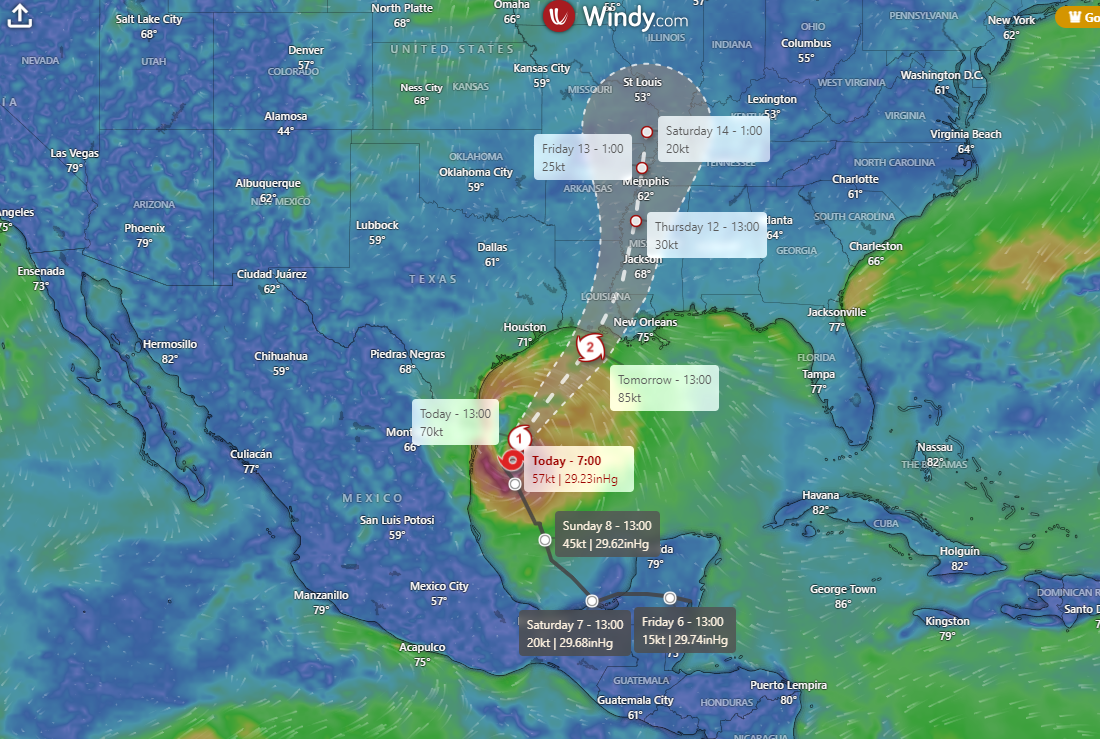
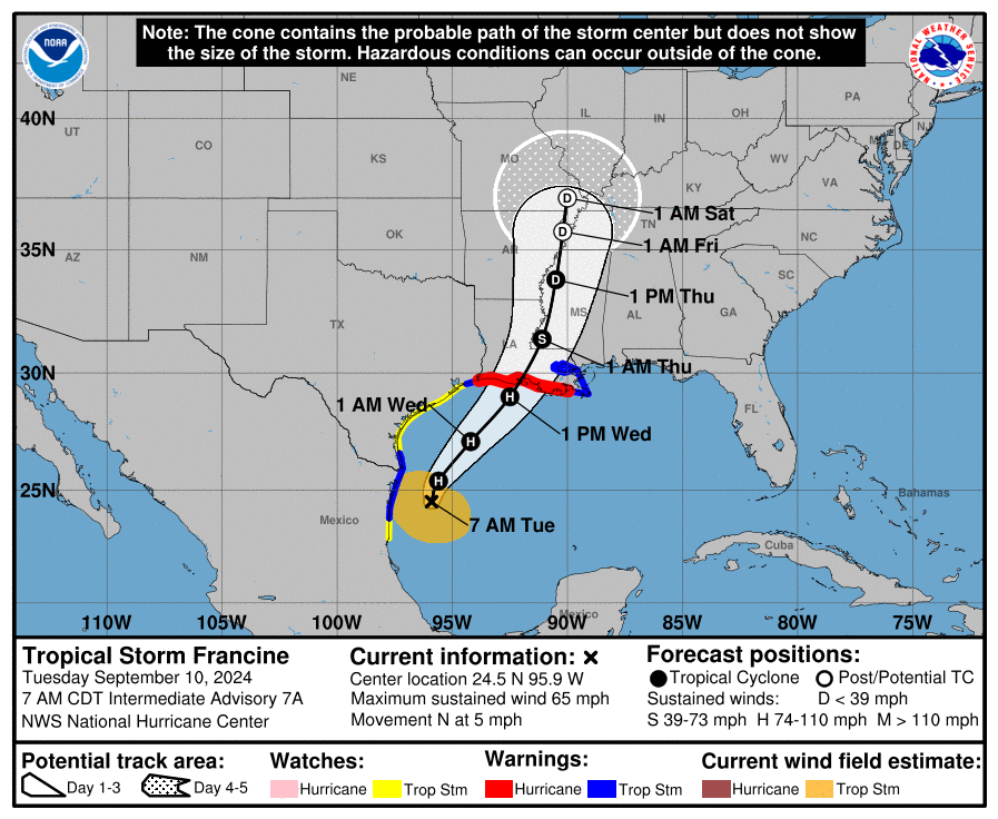
Updated 7:20PM. Francine has been upgraded to a hurricane as of the 7pm CDT forecast advisory with sustained winds of 75mph. Hurricane Francine is forecast to make landfall as a hurricane between New Orleans and Lake Charles, Louisiana on Wednesday morning. The primary impacts for our area will be strong rip currents, high surf, marine advisories.
CLICK HERE FOR LIVE DATA STREAM
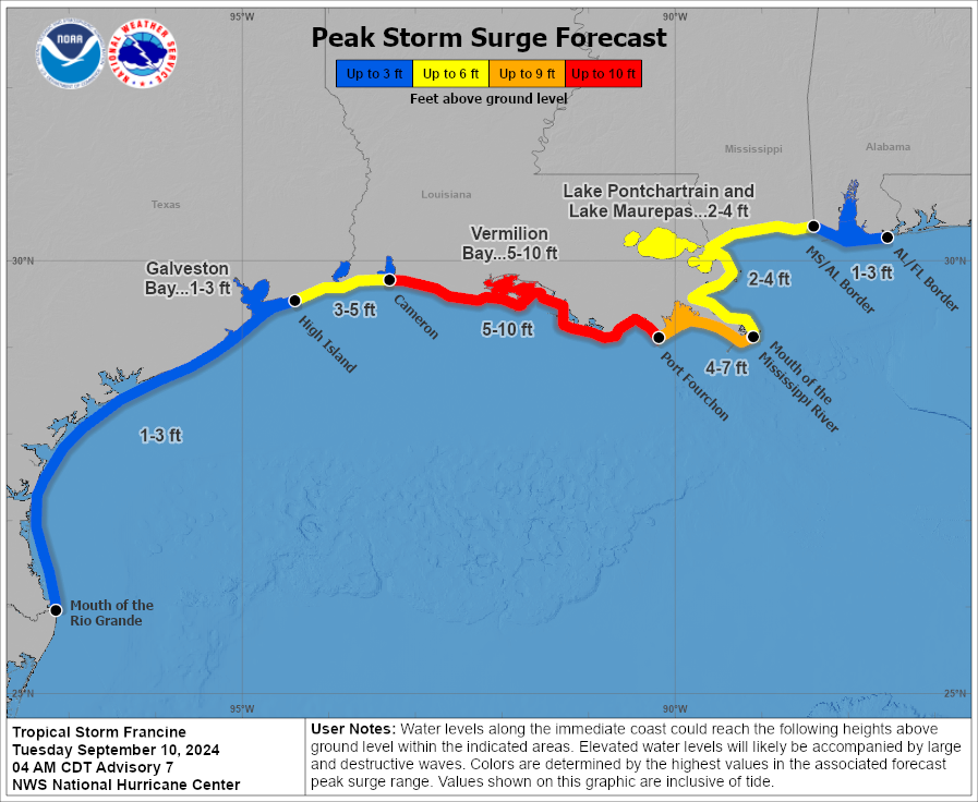
The primary impacts for our area will be strong rip currents, high surf, marine advisories. Depending on what the rain bands do, we could see potentially heavy rain, minor coastal flooding, gusty winds, and the potential for waterspouts along the coast and tornadoes inland. We are expected to have a 1-3 foot storm surge from Francine.
Bullet Points:
- High risk of rip currents Tuesday through Friday night
- High surf advisory Wednesday through Thursday night
- Minor coastal flooding in coastal Alabama Wednesday into Thursday
- Locally heavy rains and potential for localized flash flooding from Wednesday into Thursday
- Isolated tornadoes are possible from Wednesday into Thursday
Be Prepared:
Hurricane Francine serves as a good reminder for residents along the Alabama Gulf Coast to stay vigilant and prepared during hurricane season. Even when a storm seems distant, the unpredictable nature of hurricanes can lead to sudden changes in intensity or direction, as seen in past storms, like Hurricane Sally. Preparedness is key to minimizing damage and ensuring the safety of you and your family.
Here are some important steps to take in preparation for hurricane season:
- Create an emergency kit with essentials like water, non-perishable food, medications, and flashlights.
- Secure outdoor items such as patio furniture or loose debris that could become projectiles in high winds.
- Review your evacuation plan and know the evacuation routes for your area and the location of the nearest shelters.
- Stay informed by monitoring local weather updates and having battery-powered radios.
- Prepare your home when a hurricane threatens your area by boarding windows and doors, especially if you live in coastal or flood-prone areas.
- Check on Family & Friends, particularly the elderly and those with medical conditions, to ensure they have a safe evacuation plan and necessary supplies. These individuals may need extra assistance preparing for or responding to a storm.
- Check your insurance coverage to ensure you're protected against hurricane-related damages.
For more detailed information on hurricane preparedness, visit the
NOAA Hurricane Preparedness website.
CLICK MAP BELOW FOR REAL TIME UPDATE


Recent Posts