Tropical Storm Helene Update: Sustained Winds At 65MPH and Growing
News Staff • September 25, 2024
Projected path of possible hurricane
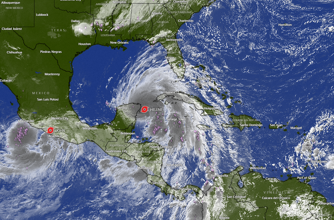
While the future hurricane "Helene" is not forecasted to be a direct threat to the Alabama coast, locals should stay alert for wind and surf reports during the week. The storm is projected to strengthen and make landfall at Florida's west coast region. The sustained winds are currently at 65mph and rising. If they reach 74mph Helene will officially become a hurricane. The storm is expected to reach that status later today and could make landfall as a Category 3 hurricane.
As is passes through the Gulf, NOAA is forecasting the following weather for the Gulf Shores area:
Wednesday
A chance of showers and thunderstorms, then showers and possibly a thunderstorm after 1pm. High near 84. North wind 5 to 10 mph becoming east in the afternoon. Chance of precipitation is 80%. New rainfall amounts between a quarter and half of an inch possible.
Wednesday Night
Showers and possibly a thunderstorm before 1am, then showers and thunderstorms likely between 1am and 4am, then showers likely and possibly a thunderstorm after 4am. Low around 73. East wind 10 to 15 mph, with gusts as high as 20 mph. Chance of precipitation is 80%.
Thursday
Showers likely and possibly a thunderstorm. Mostly cloudy, with a high near 81. Breezy, with a north wind around 20 mph, with gusts as high as 40 mph. Chance of precipitation is 70%.
Thursday Night
A 20 percent chance of showers and thunderstorms before 1am. Partly cloudy, with a low around 71. Breezy, with a west wind 15 to 20 mph, with gusts as high as 35 mph.
SEE REAL-TIME RADAR AND WINDS HERE
As locals are aware, the path of a hurricane can quickly change. Remember to stay aware and check at weather.gov for any changes to the storm's path. You can quickly check our link HERE for real time satellite views and wind reports.


Recent Posts